
Start with one problem
Measuring a mountain from two places.
You can see the summit. You cannot walk to it with a measuring rope. What can two observations tell you?
In this passage, al-Karaji describes a sighting instrument, two stations on a level line, and a sequence of measurements. The difference between the sightings makes it possible to calculate distances that cannot be measured directly.
From the working translation
The excerpt begins partway through a sentence and ends before the next procedure. Bracketed comments identify editorial restorations.
LJS 399 · 38r
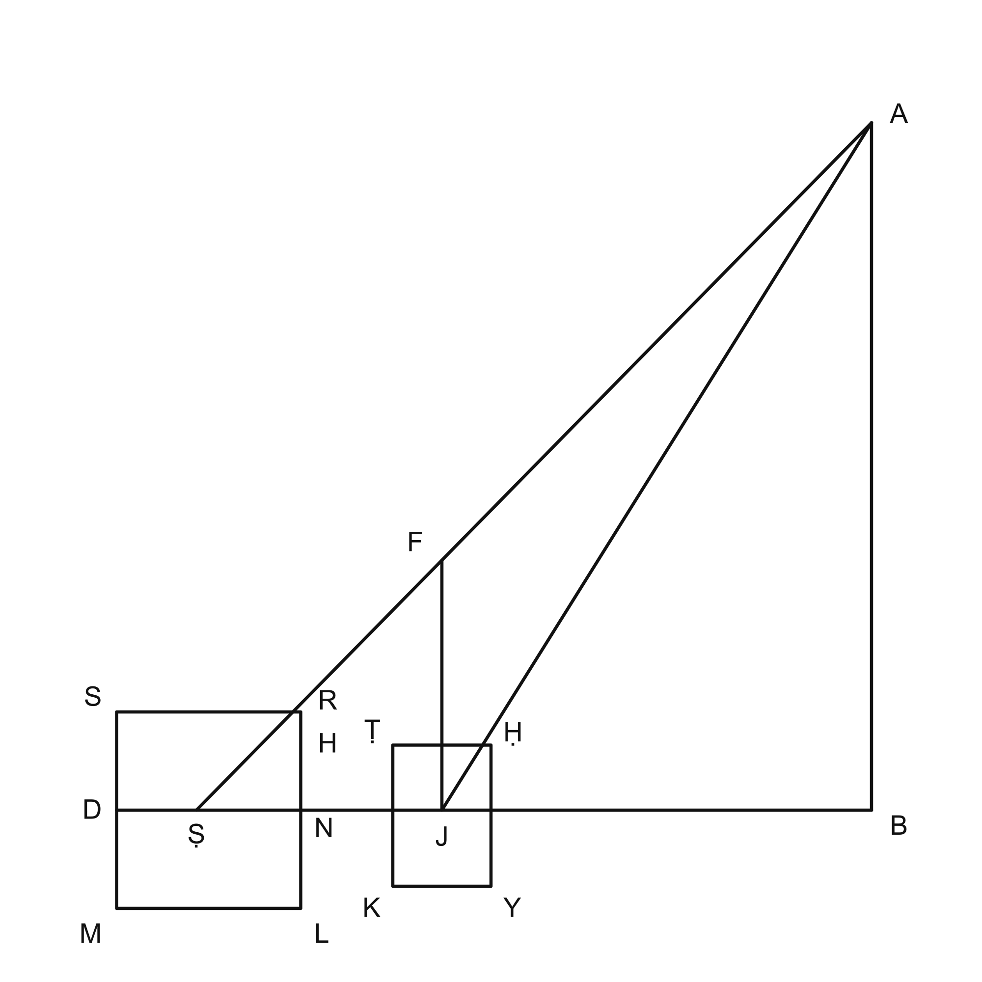
… the line dropped vertically from its summit to the horizontal plane on which you stand, extended straight beneath the mountain; or if you wish to find your distance from its summit or any visible point upon it, first choose two stations at the same level.
Suspend the instrument from its support and set its foot at the station nearer the mountain. Direct the tube toward the summit, look through it, and mark the point indicated by its end on the graduated edge.
Then move to the other station in a straight line, so that the foot of the mountain's perpendicular and the two stations lie on one line. This is easy to arrange. Set up the instrument, sight the summit again and mark this second position of the tube's end.
Count and record the divisions, including fractional parts, between the two marks. Also record the divisions between the end of the horizontal line and the second mark. Measure and record the distance from the center of the instrument to the first mark; the divisions on the tube can be used for this after it is detached from the plate. Then determine the distance from the center to the end of the horizontal line …
LJS 399 · 38v
… through its center parallel to the horizon, and retain the measurement. You now have four recorded distances.
Multiply the parts of the second elevation—the distance between the end of the horizontal line and the second mark—by the distance in cubits through which you moved. Divide the product by the parts of the horizontal line reckoned from the center. Call the result the first retained quantity, and keep its value in cubits.
Then multiply the measured distance from the center of the alidade to the first mark by the first retained quantity, and divide by the interval between the two marks. This yields the distance in cubits between the first station and the mountain’s summit. [The operation in this paragraph is restored from the explicit proof on 40r; the wording here is defective.]
Multiply this summit distance by the parts of half the line parallel to the horizon, and divide by the measured distance from the center of the instrument to the first mark. [This division is restored from the following proof; see the note.] The result is the horizontal distance between the first station and the foot of the perpendicular from the summit, on the plane through the station. Subtract the square of this distance from the square of the distance between the summit and the first station, then take the square root of the remainder: this is the mountain’s perpendicular height.
What makes this passage worth checking?
The arithmetic instructions on fol. 38v are defective in this copy. The edition restores two operations by referring to the explicit proof on fol. 40r. Those interventions remain marked in the translation.
This is one of the pleasures and difficulties of reading a historical technical work: the instrument, the picture, the words, and the proof each provide evidence, and they do not always line up neatly.
What was unclear?
Tell us where you paused or what you would need explained before continuing.
Send feedback